Labrador Iron MinesHoldings Limited |
|
 |
Schefferville Area Projects |
James Deposit
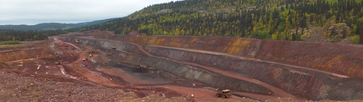
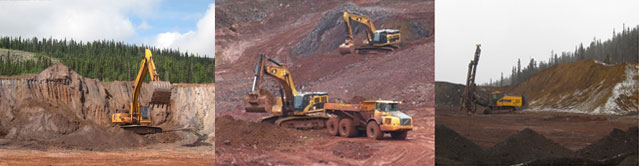
LIM has a 100% interest in the James Mine, located within 3 km of the town of Schefferville and next to the Silver Yards processing plant. The Schefferville area features existing infrastructure, including an airstrip, hydropower and direct railway service to the Port of Sept-Iles, Quebec. Initial production at the James Mine commenced in June 2011. From the period June to December 2011, a total of 1.2 million tonnes of ore were mined. Of the total production, approximately 440,000 tonnes were direct rail ore at an average grade of 65% iron, of which 340,000 tonnes had been railed directly to Sept-Iles without further processing. In addition, approximately 570,000 tonnes of ore had been fed to the plant, yielding approximately 230,000 tonnes of lump and sinter fine products. Full scale mining operations at the James Mine commenced on April 2, 2012 and the mine completed its first full season of production in November 2012. During the 2011 and 2012 operating seasons, LIM sold 13 shipments totalling approximately 2.0 million dry tonnes of iron ore, all bound for delivery into the Asian markets. LIM completed its third operating season at the James Mine in November 2013, achieving its production target from its operations of 1.7 million tonnes of iron ore No mining operations were undertaken at the James Mine in 2014.The James Mine is located adjacent to the Silver Yards processing facility, which includes the process plants and railway siding for loading of trains. These deposit spans a total length of approximately 880 metres by 80 metres wide and 100 metres deep of direct shipping grade ore. Other facilities at the James Mine include a mine accommodation camp for contractors and employees, site offices, laboratory, maintenance shed, and warehouse facilities. The property straddles the existing road to the Redmond property to the south, which continues to the Menihek hydroelectric dam, a distance of some 40 kilometres. Hydro power is available throughout the full operating season, and potentially during the winter off-season, depending on grid capacity and local demand.
GeologyThe James deposit is a northeast dipping elongated iron deposit with a direction of N330 degrees in its main axis and it appears to be structurally and stratigraphically controlled. The stratigraphic units recorded in the James area go from the Denault Formation to the Menihek Formation. The main volume of the mineralization is developed in the Middle Iron Formation (MIF) and lower portion of the Upper Iron Formation (UIF) both part of the Sokoman Formation. The iron mineralization in the James deposit consists of thin layers (<10cms thick) of fine to medium grained steel blue hematite intercalated with minor cherty silica bands <5cms thick dipping 30 to 45 degrees to the northeast. The James mine mineralization has been affected by strong alteration which removed most of the cementing silica giving it a sandy friable texture. The relatively low magnetic nature of mineralization found in James can be identified as magnetic lows due to the stronger magnetic nature of the surrounding unaltered iron formation and the alteration of magnetite to martite (a non-magnetic mineral) during the formation of the ores. |
Home | Corporate Information | Shareholder Information | Projects | Environment & Social | News Center | Contact Us © 2026 Labrador Iron Mines All Rights Reserved | Disclaimer & Privacy Policy |